New online tool helps communities understand climate risks
.
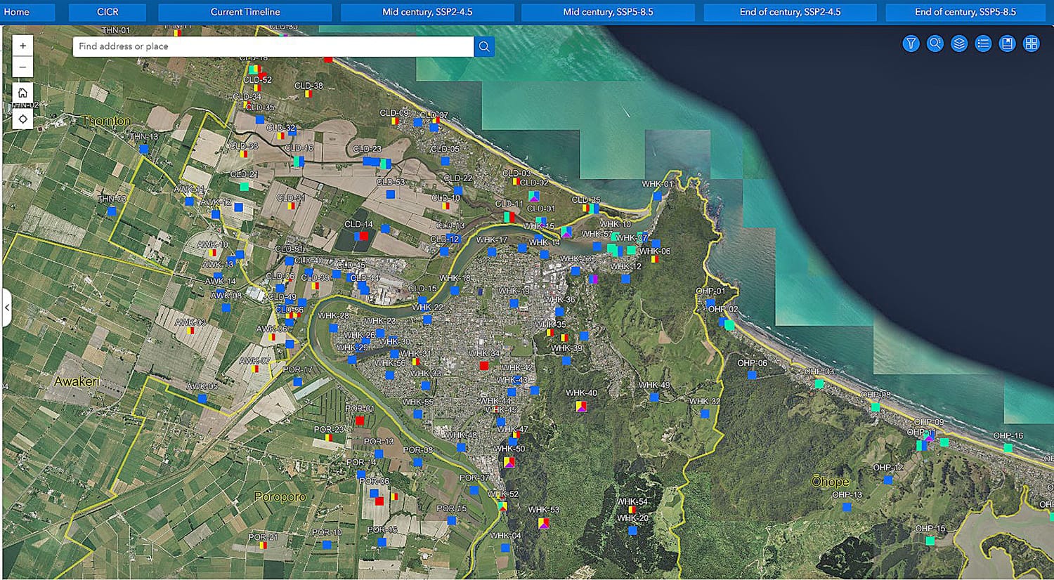
Whakatāne District Council has released a new online mapping tool to help people better understand how climate change and climate-related hazards could affect different parts of the district, now and into the future.
Called Adaptation Explorer, the tool is an interactive digital map that shows general areas that may be exposed to climate-related hazards such as flooding, landslides, coastal erosion, sea level rise and extreme heat.
People can type in an address and explore different climate-related hazards and risks across the district. The tool is designed to support learning, awareness and early planning, rather than provide property specific answers.
Lou Hunt, climate change and resilience manager, said Adaptation Explorer was about helping communities understand risk earlier, so they could respond.
“Climate change isn’t something we’re expecting to happen one day, it’s already affecting parts of our district,” she said. “Adaptation Explorer helps make that information easier to see and easier to talk about.”
Adaptation Explorer has been developed as part of the council’s wider Climate Change Adaptation Programme, which is based on the Whakatāne District Climate Change Risk Assessment completed in 2025.
The assessment was prepared by Tonkin and Taylor and Council staff ,and involved more than 800 people, including iwi, hapū, community groups and technical experts.
Ms Hunt said it was important people understood what the tool was, and what it was not.
“The maps show climate-related hazard areas across the district, and the risks communities have observed. They don’t assess risk for individual homes or buildings,” she said. “It’s a guide to help start conversations and ask the right questions.”
The council said the effects of climate change are already being felt across the district, with more frequent storm events, flooding, landslides and coastal erosion, as well as hotter, drier conditions. Making this information publicly available supports informed decision -aking and helps communities, businesses and the council plan so that the district is more resilient to future climate-related hazards.
“When we understand risk earlier, we can make smarter choices and avoid costly mistakes in the future,” said Ms Hunt.
“This is about building resilience together, using the best science available alongside local knowledge and community input.”
The council emphasises that property-specific risk is not identified in Adaptation Explorer as this depends on many factors, including building design, location and any onsite mitigation works, and may require professional advice.
Ms Hunt said the work would continue as new information became available.
“This isn’t a one-off piece of work,” she said. “The data will continue to be updated as we learn more and as conditions change, and that will help guide future planning and investment decisions.”
Adaptation Explorer is available now on the Whakatāne District Council website.
[whakatane.govt.nz/climate-change-risks]
People are encouraged to read the FAQs alongside the tool, which explain how the mapping works, what it may mean for LIMs and insurance, and where to find more information.
Drop-in sessions:
The council is running three community drop-in sessions at the council chambers where people can learn to use the Adaptation Explorer tool.
■ March 31, 10am-12pm
■ April 14, 10am-12pm
■ April 28, 10am-12pm